Sunday, October 29, 2017


LAST CALL


Alas, the old blog site, having served its purpose, is not longer being updated. But the good news is we have a brand new and even better Blogsite over at Wordpress where we plan to continue and expand our posts! Check in at www.becauseitzthere.com for a preview.

-Brian & Sylvia

Friday, October 27, 2017


We'll soon have a new home! The new and improved BLOG 2.0 site, BecauseItzThere, will be making its debut shortly! Check back for details.

Saturday, October 21, 2017


THE JUMP OFF, NEWFOUND GAP, AND OTHER PLACES WE SORT OF SAW…

For the second day of hiking in the Smokies I decided to make the hour long drive to Newfound Gap, where we would do the Jumpoff. This is the second most popular hike out of Newfound Gap, after Charlie’s Bunion, which is probably the second or third most popular hike in the entire park. I had done the bunion; now, I wanted to see the Jumpoff as well and I was bringing Sylvia with me.

Newfound Gap sits in the spot where US Highwat 441, which is the heavily travelled main east west route through Great Smoky Mountains National Park. It is also located directly on the Tennessee-NC State border, and every day thousands of people stop to queue up and have their picture taken next to the famous sign…

 
Look! I'm on the border!!! Taken in 2011 in better weather.


…what many of them perhaps don’t realize is that the Appalachian Trail runs along the Tennessee-NC border throughout most of its distance through the park, so there is nothing at all unique about that spot at all, except there is a sign there.

We left Cosby campground where it was an overcast but still mild day. Once past Galtinburg, the clouds began to move in; by the time we had reached the gap, it was a full on freezing rain storm. We suited up in rain gear and began the hike anyway, knowing that the chances of seeing anything more than clouds today was likely very low.
Newfound gap is heavily visited at any time of year. This was a Saturday in the early part of fall leaf season, and so it would have been overrun on a clear day. As things were, it was merely packed. There are few sections of any major city that are as busy as the most heavily visited sections of GSMNP at peek season.

The Hike out to the Jump off is almost entirely on the Appalachian Trail, only moderately difficult through this section. The trail rises steadily before levelling out, and barring a few rocky scramblest he foot path is mostly easy. This, and the proximity to the parking lot, make it a very popular hike with people who otherwise never travel by foot in the wild at all.

Maybe it is my own bias, but coming from New England, it seemed like there were a LOT of great viewpoints that could be hiked to. The Smokies, for all its splendor, is mainly devoid of sweeping vistas. And even when you get them, bad weather or the haze in the air (partially pollution, partially pine spores) degrades it. At any rate, you have to hike an awful long way to get a great view in the Smokies. But this does not stop it from being the most heavily visited National Park in the US.
The trail continue until an intersection with the Boulevard Trail…there are no views on this section, except for a few blowdown patches which can be reached via side trails. At the Boulevard Trail goes straight, and the AT breaks Right, headed away toward Charlie’s Bunion, another mile and a quarter down the way.

We followed the Boulevard, which will eventually take a hiker to the impressive views atop of Mount Leconte. We climbed it earlier this year by a different trail. (Both of the parks most famed mountains, Le Conte and Clingman’s Dome, are a relatively long but doable hike out of Newfound Gap.) Very soon the side trail to The Jumpoff came up. This is somewhat rougher than the preceding sections of trail, and seemed long, though it is less than a quarter of a mile. The slippery rocks didn’t make it any easier.

Finally, we arrived at the view! It looked like this…


…stunning views of nothing but cloud! We lingered by this magnificent view of nothing in a sheltered spot, out of the drizzle, had some snack bars before making our way back to the car. On the way, we passed a pair of young men at the AT junction who were backpacking, and seriously considering making an attempt at the Mt. Leconte summit. I advised them as best as I could and walked on. Later, we encountered another much less well prepared man asking the same sorts of questions, whom I dissuaded from the attempt (13 miles round trip begun late in the day, for a guy wearing tennis shoes. Ill advised.)

…and then back in the car and the swarms of people, and Sylvia chiding me for my complaining about swarms of people.

We would recommend the Hike out to the jump off for any fit hiker, and maybe even a less fit one in search of a challenge. Experienced hikers will not find it challenging. But do it in good weather and come either mid-week, or off peak. This trail is CROWDED and there is very little room at the overlook, which in clear weather will be mobbed. It is entirely possible to do both this and Charlie’s Bunion in one hike, as the entire distance would be less than nine miles and the challenges not that serious; but realistically, the view from the Bunion is similar but more open and held to be better, so it is debatable if doing both is worthwhile. I would recommend the Bunion over the Jumpoff, but in clear weather…personality I do not think either compares with Mt. Chocorua in New Hampshire, to name but one place.


NEXT UP: Auto touring on the BRP!!!


At last...the Old Rag Rock Scramble Video!

It's a log one...some shaky cam.

https://youtu.be/8yUM9WlrzkQ


Old Rag Hike is a blast!!!

Thursday, October 19, 2017

Mt Cammerer Hike


MT. CAMMERER FIRE TOWER

The second week of October seemed like a promising one for Fall Colors and for great hiking, and so we packed up the car and headed for Great Smoky Mountain National Park for a 4-day weekend. We had an open agenda for the trip, and only at the last minute did our plans congeal and we set on Cosby campground for the stay. Just 30 minutes East of Gatlinburg, on the Tennessee side, his is one of my favorite campground in the smokies (the other being Deep Creek on the NC side) and one of the few where one can hope to find some degree peace and privacy on a busy fall weekend in this, America’s most visited national park.
Cosby Campground. 

Cosby is the jumping off point for the Mount Cammerer Fire Tower Hike, which I had originally done back in 2008. Though it is one of the best views in the park, I had not planned on doing it again. Sylvia, who had gotten tired of hearing me rant about Gatlinburg,  convinced me to do Cammerer again with her, instead of another hike closer to town. And I am very glad that for the second time in my life, I listened to her.


The Mount Cammerer Fire Tower sits perched atop a rock outcropping at the top of a 4928 foot mountain of the same name. Cliffs drop off impressively on two sides of the summit, giving unobstructed views to the North and East, as well as good vantages of the adjacent higher ridge lines on the south and west. In Fall, there is no better view in the Southern Appalachians. We set out for the summit hoping for good weather.
mount-cammerer-tower
Photo courtesy www.hikinginthesmokys.com

The summit lies just a half mile off the Appalachian Trail, which comes up from Davenport Gap on its way to the summits of Mounts Guyot, Leconte and Clingman’s Dome. The AT itself is reachable from Cosby campground via the badly misnomered Low Gap Trail. Folks, there is nothing low about this gap…the hike up to it via a well graded horse trail is a steep, unrelenting slog. There are no flat areas at all along this section of trail.

Sylvia and I walked directly out of our campground to the trail. After crossing Cosby Creek the trail begins its aggressive climb. The first few miles to Low Gap are quite steep, but the footing is good, being intended for use by horses. At about three miles the intersection with the AT is reached in a col full of wilted, late-season wildflowers, abuzz with bees and flies. (in 2008 when I did this the first time it was positively swarming; less so this time.) Past the gap, the AT climbs at a modest grade, and then levels out entirely. Excepting a single blowdown patch there are no views on this section trail. There is in fact only one view to be had on the hike, and that is a great one, but it is still to come.
The Appalachian Trail


Two miles beyond Low Gap the Mt. Cammerer trail diverges from the AT, and here we passed a large group apparently coming up from Davenport Gap. Just past the junction is a horse hitching post – this being the furthest point you can take a horse, if a horse you’ve got. The trail becomes a bit more uneven, though still short of a rock scramble, then breaks out into the clear where the first views of the tower is had. After this it is a short walk over a few outcrops of rock to the foot of the tower.

The tower itself is quite different than the usual fire towers that can be seen throughout the eastern US. Instead of being a tall, steel framed structure, this thing looks almost like a garden gazebo. I know of no other tower quite like it. It has an impressive stone foundation of quarried granite atop which sits a wooden-decked one room octagon with windows. Originally built by the CCC in 1930, the tower fell out of use in the 1960s, but has been maintained since then by volunteers.
Add caption
The Mount Cammerer fire tower is a 'western style' fire tower.

The volunteers had been at work recently. During my first visit the deterioration of the tower was quite apparent, especially the interior which was little more than a trash strewn abandoned building. This time there was a marked change; not only had the roof and deck been repaired, but the interior had been cleaned out and restored as well. Instead of garbage, rot and gaping holes in the floor all was in good order. There was even a broom leaning against the wall for sweeping...which of course my wife insisted on doing. It appeared however that in some respects the workers had been perhaps too enthusiastic, as of roofing material had been hurled off the side of the tower down the cliff…much of which was caught in the surrounding shrubs in plain view. I am not sure the National Park Service approved of that but, you can’t fault the obviously fine job whoever it was did on the tower.


Here is an interesting website about the historical fire towers of Tennessee, most of which are no longer in operation. Technically, the Mt. Cammerer summit is right on the Tennessee-NC state line, but the tower was maintained from the Tennessee side, probably because the best vantages are west.


The deck of the fire tower.

The view from the tower and surrounding rocks speak for themselves. Though it is a small summit, the long hike in acts as a crowd control buffer. This is a place for serious hikers. There were three or four other groups present at the same time we were there, many of whom simply collapsed inside the tower from exhaustion and scarcely emerged. We had no issue finding a spot to have to ourselves.


There is more to see at the summit of Mount Cammerer than just the fire tower.


The trip down was mostly as I remembered it, a knee-pounding two-hour slog back to the campground. On the way Sylvia did do her best to liven things up by attempting to fall into a stream, but emerged scarcely more wet than when she entered.

We found the Mt. Cammerer Fire Tower Hike via the Low Gap, Appalachian and Mt. Cammerer Trails to be a very challenging hike, just the very thing for a pair of hikers trying to condition for the major ups and downs of the Alps. The trail itself presents no serious challenges apart from its length and, in the two miles before Low Gap, unwavering grade. Most hikers will require a good six hours, at least, to make the out and back. It is a long and exhausting day to get to one view, albeit a stunning one. If care is taken to avoid the summit and the approaching ridge when thunderstorms threaten, this is a trail that can be done in any weather without significant danger of exposure. However, it is also a trail to save for good weather. It’s an awful long way, so you want to make sure there’s a payoff at the end of it.

In our opinion the Mt. Cammerer Fire Tower Hike is suitable for all fit hikers looking for a challenge. It is roughly comparable to Alum Cave Trail/Mt. Leconte in terms of difficulty, but we liked Mount Cammerer better. Alum Cave Trail is more publicized and does have more interesting things to see on the way up, but is also FAR more crowded, and Sylvia and I both think the view from Camerrer’s summit is superior. We recommend this hike as the best we have done so far in the Smokies.


NEXT POST: More from the Smokies!!!

Wednesday, October 18, 2017


VIDEO: MOUNT CAMMERER FIR TOWER HIKE!

See our new GoPro video on YouTube...

https://youtu.be/bQrG2G2-Cag

https://www.youtube.com/watch?v=bQrG2G2-Cag&t=56s

Blog Post coming soon!

Wednesday, October 4, 2017


October 4

Tomorrow we leave for the Smokies....3 nights, hope to hike at least a couple of serious trails. We probably will NOT get to do Gregory Bald or Rocky Top simply because it's difficult to stage to those hikes in Cades Cove from any available campground. Save this for later...we'll hit some of the hikes in the Cosby, Greenbriar and Gatlinburg area. Hopefully fall colors have started. Major concern will be the heat....unseasonably warm this fall...and maybe a chance of bad weather Saturday night and Sunday. Could be tough drive home. Stay tuned!

Oh...and by the way thanks for stopping by, we're now over 1000 views all time!


Lineville Gorge Wilderness from the BRP

Tuesday, October 3, 2017


September 2017


OLD RAG MOUNTAIN


This year, Sylvia and I are tackling some of the most challenging hikes and scrambles remaining in the Southern Appalachians in an attempt to ratchet the bar up to a higher level. After all, if we can’t measure up to the mountains in our own back yard, then how can we hope to be ready for the much steeper prospects of the Alps, Dolomites and Patagonian Andes, to name but a few?

In April we had done the quintessential Carolina/Tennessee Hike – Mount Leconte – to prepare for our adventures in Peru. Now, with an eye toward bigger things next year, we set out to attempt yet another of the South’s “Must do” hikes – Virginia’s Old Rag Mountain.

Long considered the best hike in Shenandoah National Park, Old Rag has a reputation as being unparalleled both in scenic views and in challenge. It is also not without its dangers…with over a mile of intense boulder scrambling, this is not a trail for novices, nor for the faint of heart.


From Skyline Drive, Shenandoah NP

Even getting to the hike is a challenge. Though located entirely inside the National Park, the trailhead itself can only be reached by driving a considerable distance outside of it…nearly 10 miles South of Sperryville, VA, which is in itself seven miles from the Park's Thornton Gap entrance. To stage for the Hike, we stayed overnight in Mathews Arm campground, a 40 minute drive from the trailhead. 
Despite its remoteness and formidable reputation, Old Rag is a popular mountain…maybe THE most well publicized hike in Virginia. As proof of this, the NPS parking lot off state route 601 often fills to capacity on summer weekends despite accommodating 250 vehicles. We chose to hike on a Monday in the ‘tweener’ season of late September, hoping to avoid the crowds, and we were entirely successful. Instead of sharing the trail with hundreds, we shared the mountain with only a few score, and these well spread out. For most of this hike we were quite alone.
We were less successful in avoiding the summer heat…fall had begun, but somebody had forgotten to tell the weather. We started off in buggy heat that seemed to be about 80 degrees in the valley, though it was probably less.


Challenges aside, nearly half this trail is a road slog. The old and inadequate parking area has been closed, forcing hikers to  walk an additional three quarters of a mile (both ways) down a mostly non-scenic rural road. Where the black top ends, the Old Rag trail breaks sharply uphill to the left. Straight ahead at the same junction, the Weakley Hollow Fire Road comes in. Along this mild road hikers will close the loop on their return, some hours hence.

The next two miles on dirt/rock are a steep but uneventful uphill climb in the trees. The only things of note on this section, beside the bugs, are the increasing number of trailside boulders…a reminder that soon, the trail will be nothing but boulders. At about three miles in, the real fun begins. A steep and uneven rock stairway takes the hiker up past a sign proclaiming a no camping zone…and here the first of the rock scrambles appears, a long and steeply pitched cracked slab of granite, atop which is a very fine view from a ledge down the mountain's more populated front side.   


Leaving the ledge, the notorious scrambles intensify, entering perhaps the most challenging one of all…the one that more than any other makes the clockwise direction the advisable way to do this loop. A 10-foot deep crevasse yawns between slabs of solid rock, affording only sketchy handholds. This plagued us for a few minutes and caused me to drop my head-mounted GoPro down onto the rock, but they do make those things to last…this one certainly survived the fall none the worse for wear.


Exiting the crevasse, the trail makes its way around the backside of the mountain, affording one stunning view after another. But you won’t have much time to look at them because for the next mile, you will be grasping, leaping, crawling and straining your way across broken terrain. You cannot just walk this trail…each and every challenge must be answered differently. Among the highlights:
  • A granite slab leaning precariously against a cliff; the trail goes directly through the keyhole between
  • A short traverse of a claustrophobic cave through the rock (I had to crawl, but shorter hikers could probably duckwalk)
  • A narrow chute, directly in the middle of which is lodged a massive multi-ton boulder. Recalling the film 129 hours, the anxious hiker is forced to go straight underneath this hanging obstacle
  • After this comes an startling, gravity-defying rock formation that looks like an upraised fist
  • And after this...more balanced rocks than ANY other trail I have seen east of the Rockies

The Old Rag Trail tantalizes with at least two false summits before throwing the final challenge at you…a long, white-knuckle ascent up a boulder strewn defile, dead in the center of which is an inconveniently placed block. For me, this proved to be the most formidable obstacle of the day; the weight of my pack, combined with the unseasonable heat, a dwindling water supply had worn me down.  Not helping either was a comical (for anyone but me) episode where my foot became stuck for five minutes in a crack (Sylvia, cursing my ‘lack of flexibility’, impatiently seized it with both hands intending to pry it loose before I convinced her that, no, I really needed both feet for this hike.)


The only place I have seen more strange and unusual rock formations than this is in Utah.

Sylvia posed next to a pair of very unusual formations, one of which uncannily resembles a human being with a GoPro sticking out of his head.


After several minutes of flopping about ineffectually, I finally took off my pack and hurled it up and over the obstacle. Then, and in gazelle-like fashion, I executed my patented ‘full granite body slam’ method of bouldering. Sylvia, to shame me, was able to step lightly through in just one minute to my ten, again cursing the ‘lack of flexibility’ of the gazelle ahead of her.


 The blazes at times are hard to follow, and they always seem to take you in  the least convenient direction.
Amazing Old Rag Mountain...note the almost pristine wilderness views, very rare in the Blue Ridge

Fortunately for us, the 3,284 foot summit was just ahead. There we lingered on the expansive granite slabs, resting and enjoying 360 degree views almost to ourselves. Here the intrepid climber is rewarded with something rarely seen in Virginia – mountainsides and valleys almost completely unspoiled by development. The backside of Old Rag looks out into the lesser seen interior regions of the National Park, and only those few who venture far from Skyline Drive and the park’s more popular overlooks will ever see them.


A rare moment on the trail when  Sylvia was not being obstructed by a large object such as her husband.

Just as with my earlier visits to the Smokies, I was disappointed by the very noticeable amount of haze in the air, which greatly detracts from the views. The proximity of both parks to heavy industry and coal fired power plants in the Midwest makes this the case, and it seems worse in both spots than it does in the middle regions of Virginia and the Carolinas, perhaps because of the prevailing winds. I am not sure if it is my imagination or not, but the pollution problem seems to have gotten much worse than the first time I laid eyes on the Shenandoah valley almost twenty years ago.


 The summit of Old Rag  -- not the highest mountain in Shenandoah NP (or even close.)


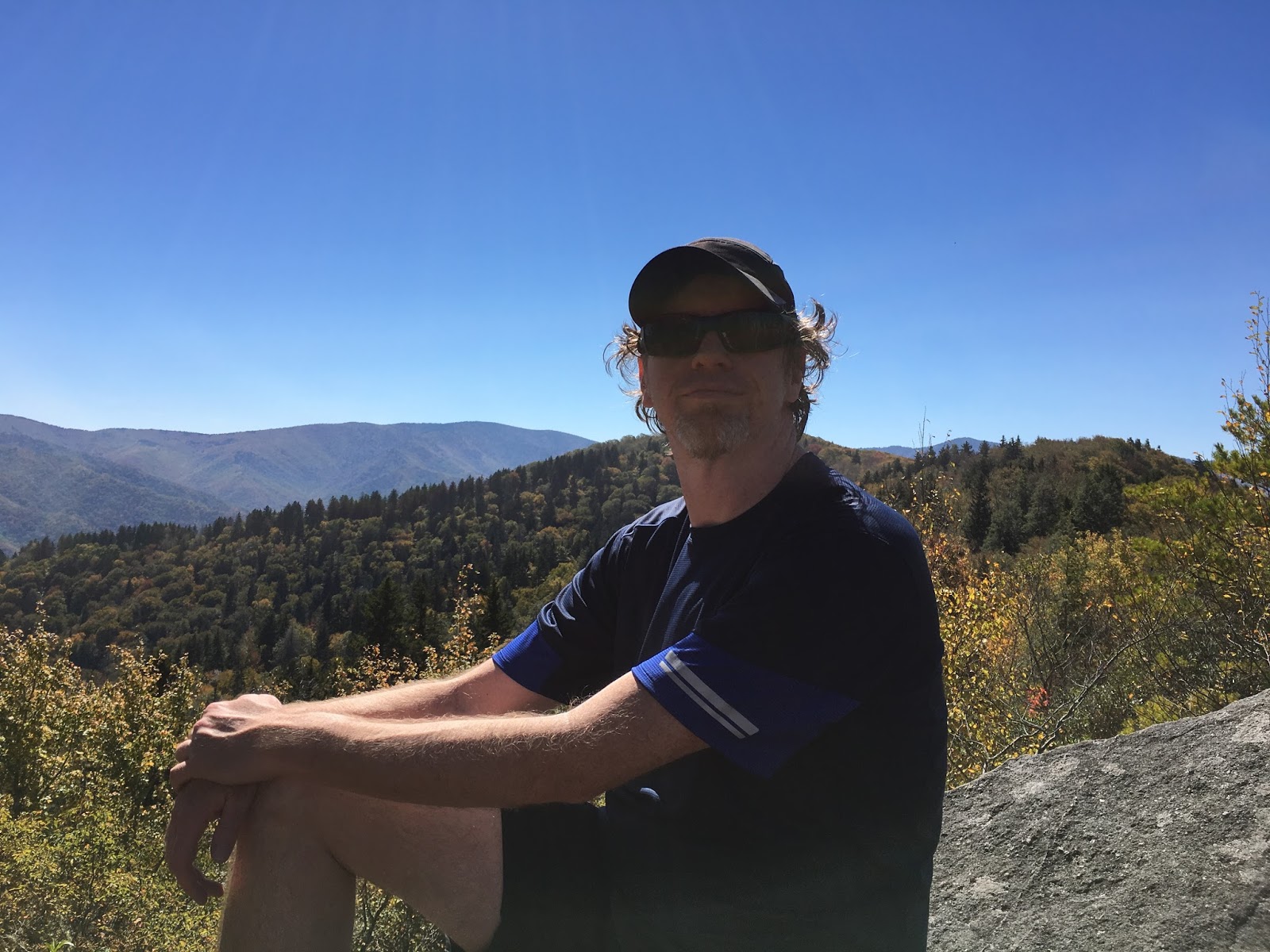
Sylvia has found her husband to be brimming over with energy as usual. 


After resting and hydrating we were back on our way, but not keen on doing any more rock hopping. Fortunately for us, the scrambles were over. From the summit the Saddle Trail makes a relatively uneventful exit from the mountain. It’s long (5.2 miles from summit to parking lot) and the first two miles are steep, but it’s just a regular trail, nothing that requires any of the gazelle-like rock flopping I am known for. In less than an hour, the Saddle trail takes you past a pair of day use cabins (one has a privy) and comes out on the well-graded Weakley Hollow Fire Road. From here, it’s another hour's basic slog out

The road was actually passable to vehicles and one did in fact pass us, which turned out to be driven by the caretaker of the Old Rag Shelter. She very kindly stopped and offered us a bottle of water (much needed) before continuing on down the road.

Though the walk out itself is uneventful enough to be called boring, about a mile from the blacktop we got our last bit of excitement of this day. As we were walking along Sylvia suddenly shouted, “What’s that!” I looked up just in time to see, just two hundred feet ahead, a large, black shaggy form go loping across the trail and into the bushes. I was about to cry, “Bear!” when a second, somewhat smaller black thing came running behind the first, and that one was followed by yet another. It was a mother bear, and two cubs! Probably they had come down to a nearby creek at the end of the day for water, and bolted uphill into a rocky area at the sound of our approach.

There was no time to get a picture and no chance of following where they went, even if we were mad enough to try. We kept on walking…no pictures, alas, but we will have the memories of this encounter to treasure. (It marks the only time in twenty years of hiking that I have actually seen a bear WHILE hiking, as opposed to running across a road or through a high powered lens at a distance. Whatever the reason, bears are FAR more easily seen in the south than in New England. I never saw a single one there!)

All in all, this was one of the best days in the outdoors either of us can remember, and we strongly recommend it to other hikers, as long as they are fit, experienced and well-prepared. No actual rock climbing skills are needed here, but this is a level above being just a ‘hike.’ Anyone who is not ready for this challenge may be in serious trouble, and the NPS does undertake many treacherous rescue operations from the mountain every year.


We do offer the following pieces of advice:
Avoid the trail in bad weather. If it rains, don’t feel the need to be macho…there are 500 OTHER miles of trail in Shenandoah NP to enjoy.
Try to do this on a weekday. Crowds milling around the tough scrambles and viewpoints would have really detracted from the experience.
Don’t take a heavy pack…go as light as possible.
Be prepared to stow away trekking poles in the scrambles. Or, if you don’t absolutely need them, don’t take them at all.
Take as much water as possible, this is thirsty work. Minimum 2 liters…more if you can.
Do the trail in the clockwise direction. The obstacles seem to be a bit less insane this way, and you save the easy road walk for the end. 
Once in the scrambles, it is probably better to push on to the summit than turn back…it’s all downhill from the summit.
Finally, if you are a novice hiker who has seen this or another trail report or a video online, our advice is to tackle something a bit less extreme first. The Alum Cave Trail in North Carolina, for example. Or, McAfee Knob.


We saw bears, but alas, this is the only wildlife we filmed on the return leg of the trip.


Sunday, August 20, 2017


A year and counting...

Sylvia and I have begun our preparations for next year's epic adventure...Alpine Europe's most classic walk, the 105 Mile Tour De Mont Blanc. It's still about a year away but never too early to begin, considering that it is probably most intense hiking either of us have even done (11 days on the trail, not including rest days.) Oh, and conversational French or Italian is pretty much mandatory.

Here's a map of the whole adventure courtesy of the Rifugio Elisaebtta Alpine Refuge on the French/Italian border...

http://www.rifugioelisabetta.com


Tuesday, August 8, 2017


Time for one of my rare forays into 'Political Thought'...

The Google Guy's opinions are complete crap. They are 100% dead wrong, and demonstrably so; virtually the entire course of American history can be viewed as an exercise in proving opinions like his wrong.

However, he has a right to his opinion. Even bad opinions are protected by the First Amendment, and should be dealt with through vigorous debate and argument, not censorship and social ostracism. In other words, it is his right to be wrong.

My two cents. Back off the soap box now...please continue on with your enjoyment of cat related memes.

Sunday, August 6, 2017


Last free day: Newport, MA

We were very fortunate to be able to extend our trip to Boston for two extra days. One of these we decided to spend sightseeing a place where, in all my years in Boston, I had never been…the playground of the rich and famous, Newport, RI.


The day we chose to drive down was one of the hottest days of the summer so far in New England (though it would have been a below average summer day at best in North Carolina.) It took us perhaps 80 minutes of driving to reach Rockport from Quincy, MA. We actually found the drive easier and less stressful than the trip to Rockport. 

First stop was to check out the shopping downtown. Sylvia pronounced the boutique stores to be mostly worthy of her interest. 

About the only thing you will find for under $10 in Newport except maybe the air.

After several minutes of luxurious shopping, or standing around in closet size boutique stores impatiently waiting for this to wrap up (depending on which one of us you are talking about) we moved on to the waterfront. 

Sylvia expressed approval for several of the watercraft moored here.


Sylvia pronounced the boat above to be a 'bit much' but said the one below was 'just right.'


After looking at the boats we’ll be buying as soon as I strike oil or uranium in the backyard, we went for dinnuh on the haaaabuhside.


Sylvia looked fashionable in her hat purchased a day earlier in Rockport. She looked like she belonged in Newport.


After a couple of Narragansett Ales, I was pretty much done, and might have passed for an overmedicated schizophrenic.


A case of an over indulgence in the finer things...aka Narragansett Ale.


After a fine dinner we moved on to that there lobster corral down yonder. The lobster wrangler let Sylvia rustle up some dinner. Sylvia was of a mind to take this one home with us but…it’s a pain even getting shampoo through the metal detectors these days.


After spending time with the lobster, it almost seemed as if, for a brief time, Sylvia became one.


After touring the harbor we went for a stroll on the famed Cliffwalk overlooked the bay. It was late in the day and starting to cool off and just an excellent time to do this.


We walked about as far as Salve Regina University, in the midst of the gilded age mansions that line the cliffs. We did not go down as far as the rougher sections as we desperately short on water.


Sylvia pronounced several of the mansions to be adequate fixer uppers.


All in all, this was an outstanding time. Sylvia awarded this four Fu’s on the Fu Fu scale. A cast iron octopus weighting about ten pounds was purchased (and carried around by me for half the day) however no additional hats were bought. We also had to save the mansions of Bellevue street for another day. Sylvia pronounced them to be “Not really that great” to begin with and “not the main attraction here.” Sylvia did see several yachts which she might condescend to purchase. And as for myself, I was glad to make it back to Boston without getting lost.

Stay tuned for a YouTube/GoPro film of the trip!!!